*** 20th Anniversary: 2004 to 2024 ***
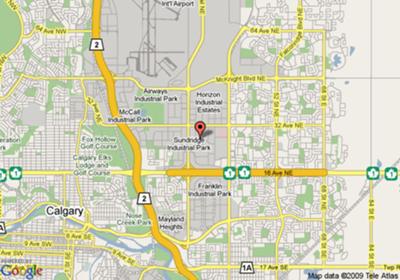
Calgary maps are city maps
by Justin
(Timber Lake)
Calgary maps are city maps wherein you can sit and decide from your home itself to the desired destination you want to reach within the city. It makes travelling a great pleasure instead of frustration when it comes to locate a particular place.
Its now dramatically easy to start from point A and to reach point B without any hassle. All we have to know is where we are now (start address) and where we want to go (ending address). You can zoom in or out, pan left or right (east-west) or even up or down (north-south). You have to select the image of an actual map as a regular atlas-type map and with the help of zoom-in you can get into the street level and can find the landmarks whichever is familiar to you.
Yahoo maps, Google maps are some best examples of this.
Barry's Response - Good. For those who need to know, it's best to go to one of these free mapping and directions services mentioned above and play with it a bit yourself.
https://maps.google.com/
http://maps.yahoo.com/
http://www.bing.com/maps/
http://www.mapquest.com/
Have fun & thanks, J.
Comments for Calgary maps are city maps
|
||
|
||
|
Click here to add your own comments Join in and write your own page! It's easy to do. How? Simply click here to return to Map Tips. |

