We had fun - Elizabeth
by Elizabeth
(Toronto, Ontario)


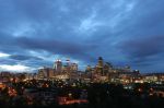
Beautiful Banff National Park
Western Honeymoon
My husband and I flew to Calgary from Toronto for our honeymoon on September 10th. We arrived at the airport and rented a car and very much could have used your map to plot our route.
The drive from the airport to Banff on the TransCanada highway is well marked and my husband had no problems finding the correct turns and routing. Still as the navigator I appreciate good maps.
I much prefer the Michelin map variety that gives distances and marks major turns and connections. I think, however, that for planning purposes the details provided are adequate. The yellow line marking the major highways is a good idea though and numbers are also good.
It would be best however if more than the top 9 cities were presented. Part of Alberta’s charm is the serendipity of driving through small towns and finding amazing ice cream or friendly diners and I would prefer a map that not only gave me a schematic idea of the route but a detailed sense of what I might find there.
Alberta is a beautiful province and much more appealing to a Torontonian than Saskatchewan – too flat (though I would love to drive through Roleau and see the town where Brett Butt shot Corner Gas) or even Manitoba – too much like Northern Ontario and too far away.
While honeymooning we stayed in the bridal suite at the palatial Chateau Lake Louise Hotel and hiked into the mountains. We eventually drove through the breath-taking mountains to British Columbia where we spent most of our two weeks out west. We loved the hospitality, kind people and excellent service, salmon and amazing Alberta beef so of course we will love to come back some time soon. Just make your maps more detailed and you will better serve the likes of us.
Barry's Response - Thanks for the advice, Elizabeth. I'll see what I can do. There are plenty of good maps online to use as well. Start with this excellent Federal Government resource that provides topographical maps for the whole country, with towns, rivers and and extensive list of other useful details.
http://atlas.nrcan.gc.ca/site/english/maps/topo/map
Comments for We had fun - Elizabeth
|
||
|
||
|
Click here to add your own comments Join in and write your own page! It's easy to do. How? Simply click here to return to Map Tips. |
Recent Articles
-
Calgary Canada Weather - You shall Never Find a Dull Moment
Mar 09, 25 01:59 PM
 Forecasts for Calgary Canada weather. Compare forecasts from Environment Canada, the Weather Network and others.
 -
Auto Trader Calgary | Do YOU Need the Perfect Car?
Mar 02, 25 09:49 PM
 Life in Calgary. Find the deal you need with "Auto Trader Calgary" or by visiting the lots on this page.
 -
oneway streets downtown
Feb 24, 25 12:20 AM
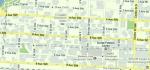 Hard to find a map of downtown Calgary that shows the oneway streets Barry's Response - Here is a crude reproduction of an olde-style Google map for the